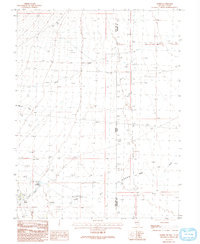
1986 Map of Baker
USGS Topo · Published 1993About this map
The high-desert settlement of Baker sits near the base of the Snake Range during the mid-1980s, serving as a gateway for the agricultural and natural features of eastern White Pine County. The landscape is defined by the drainage patterns of Silver Creek, Weaver Creek, and Lehman Creek, which flow toward the Nevada-Utah state line. A distinctive geological transition is recorded at the Sinks of Baker Creek, where the waterway disappears into the subterranean limestone system. This survey captures the infrastructure of the era, including a local Landing Strip, several Gravel Pits, and the Baker Reservoir, reflecting a community centered on water management and ranching operations. The presence of a Trailer Park near the town center indicates the modest residential and seasonal growth of this remote interior basin.
Find a feature on this map
12 named features on this map. Tap any name to fly to it.
Don’t see what you’re looking for? This feature index may not catch every label — zoom into the map to look around manually.
Map Details
Editions of this 1986 Baker Map
2 editions found
Other maps of this area

1908 · Fish Springs
USGS Topo · 1:250,000

1910 · Fish Springs
USGS Topo · 1:250,000

1949 · Garrison
USGS Topo · 1:62,500

1951 · Garrison
USGS Topo · 1:62,500

1953 · Richfield
USGS Topo · 1:250,000

1953 · Delta
USGS Topo · 1:250,000

1956 · Lund
USGS Topo · 1:250,000

1956 · Ely
USGS Topo · 1:250,000

1958 · Richfield
USGS Topo · 1:250,000

1958 · Delta
USGS Topo · 1:250,000