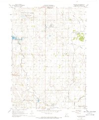
1967 Map of Balaton SW
USGS Topo · Published 1968About this map
The agricultural grid of Murray County defines the landscape of this 1960s survey, where the intersection of water conservation and prairie drainage is clearly visible. The region is characterized by significant natural depressions like Bear Lakebed and Great Oasis Lakebed, alongside numerous designated conservation zones including the Tutt State Wildlife Management Area and Klinker State Wildlife Management Area. These areas reflect a transition toward managed wildlife habitats in a heavily farmed township system.
Find a feature on this map
26 named features on this map. Tap any name to fly to it.
Don’t see what you’re looking for? This feature index may not catch every label — zoom into the map to look around manually.
Map Details
Editions of this 1967 Balaton SW Map
This is the sole edition of this map. No revisions or reprints were ever made.
Other maps of this area

1953 · Watertown
USGS Topo · 1:250,000

1953 · New Ulm
USGS Topo · 1:250,000

1954 · Fairmont
USGS Topo · 1:250,000

1955 · Sioux Falls
USGS Topo · 1:250,000

1957 · New Ulm
USGS Topo · 1:250,000

1958 · New Ulm
USGS Topo · 1:250,000

1958 · Sioux Falls
USGS Topo · 1:250,000

1958 · Fairmont
USGS Topo · 1:250,000

1958 · Watertown
USGS Topo · 1:250,000

1967 · New Ulm
USGS Topo · 1:250,000