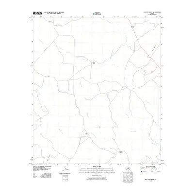
2010 Map of Balcon Creek
USGS Topo · Published 2010About this map
Isolated ranching outposts define this arid landscape in Terrell County, where cattle and sheep operations rely on the seasonal drainage networks of the Chihuahuan Desert. Scattered homesteads like Taylor Ranch, Miller Ranch, and Johnson Ranch are the primary markers of human settlement, connected by a spare network of unpaved tracks such as Shafter Crossing Rd and Harrison Rd. The topography is deeply carved by intermittent watercourses, most notably Balcon Creek and Buena Creek, which cut through the limestone terrain to form significant landforms like Prairie Canyon and Britton Canyon. This environment illustrates the vast, low-density land use patterns typical of the West Texas frontier during the early twenty-first century, where life and travel are dictated by the underlying geology and the winding paths of dry creek beds like Persimmon Creek and Indian Creek.
Find a feature on this map
17 named features on this map. Tap any name to fly to it.
Don’t see what you’re looking for? This feature index may not catch every label — zoom into the map to look around manually.
Map Details
Editions of this 2010 Balcon Creek Map
This is the sole edition of this map. No revisions or reprints were ever made.
Other maps of this area

1918 · Dryden Crossing
USGS Topo · 1:62,500

1928 · Sanderson
USGS Topo · 1:125,000

1943 · Malvado
USGS Topo · 1:62,500

1944 · Malvado
USGS Topo · 1:62,500

1954 · Fort Stockton
USGS Topo · 1:250,000

1954 · Sonora
USGS Topo · 1:250,000

1958 · Sonora
USGS Topo · 1:250,000

1958 · Fort Stockton
USGS Topo · 1:250,000

1958 · Del Rio
USGS Topo · 1:250,000

1959 · Emory Peak
USGS Topo · 1:250,000