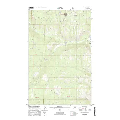
2017 Map of Bald Knob
USGS Topo · Published 2017About this map
The settlement of West Fork sits at the confluence of the W Fork Sanpoil River and the main Sanpoil River, serving as a primary point of access for this mountainous region of Ferry County. The landscape is dominated by the boundary between the Okanogan National Forest and the Colville National Forest, where high elevations like Bald Knob overlook a dense network of watercourses. Numerous creeks, including Lime Creek, Nineteenmile Creek, and Anderson Creek, carve through the terrain, while Long Lake and the Cold Spring provide distinct water sources within the protected forest lands. This 2017 survey reflects the area's ongoing management for timber and recreation, indicated by the extensive Bureau of Indian Affairs and National Forest development roads, such as BIA Rd 1004 and Nat For Dev Rd 800, which provide passage through the steep drainages of Rattlesnake Gulch and the Gold Creek valley.
Find a feature on this map
35 named features on this map. Tap any name to fly to it.
Don’t see what you’re looking for? This feature index may not catch every label — zoom into the map to look around manually.
Map Details
Editions of this 2017 Bald Knob Map
This is the sole edition of this map. No revisions or reprints were ever made.
Other maps of this area

1904 · Republic
USGS Topo · 1:125,000

1948 · Republic
USGS Topo · 1:62,500

1951 · Wauconda
USGS Topo · 1:62,500

1951 · Republic
USGS Topo · 1:62,500

1953 · Seventeenmile Mtn.
USGS Topo · 1:62,500

1953 · Bald Knob
USGS Topo · 1:62,500

1954 · Okanogan
USGS Topo · 1:250,000

1958 · Okanogan
USGS Topo · 1:250,000

1958 · Aeneas
USGS Topo · 1:62,500

1984 · Republic
USGS Topo · 1:100,000