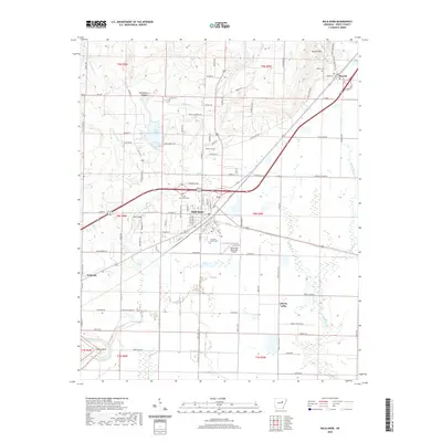
2020 Map of Bald Knob
USGS Topo · Published 2020About this map
The railroad and highway crossroads of Bald Knob anchor this White County landscape, where the Ozark foothills meet the flatlands of the Arkansas Delta. Significant local history is preserved in a series of community burial sites, including Shady Grove Cem and Bolden Cem, while the northern terrain rises toward Russell Mtn and Huckleberry Hollow. To the southwest, the Little Red River cuts through Conley Bend, marking the edge of the survey area near Judsonia.
Find a feature on this map
108 named features on this map. Tap any name to fly to it.
Don’t see what you’re looking for? This feature index may not catch every label — zoom into the map to look around manually.
Map Details
Editions of this 2020 Bald Knob Map
This is the sole edition of this map. No revisions or reprints were ever made.
Other maps of this area

1932 · Kensett
USGS Topo · 1:62,500

1935 · Kensett
USGS Topo · 1:62,500

1935 · Augusta
USGS Topo · 1:62,500

1935 · Gregory
USGS Topo · 1:62,500

1935 · Bald Knob
USGS Topo · 1:62,500

1953 · Memphis
USGS Topo · 1:250,000

1956 · Memphis
USGS Topo · 1:250,000

1957 · Augusta
USGS Topo · 1:62,500

1957 · Gregory
USGS Topo · 1:62,500
1964 · Kensett
USGS Topo · 1:24,000