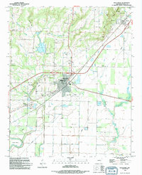
1994 Map of Bald Knob
USGS Topo · Published 1994About this map
Bald Knob serves as the central hub of this White County landscape, where the Missouri Pacific railroad corridor intersects with a network of local roads and watercourses. The topography transitions from the elevated terrain of Russell Mountain and The Cliffs in the north and west down toward the alluvial plains of the Little Red River in the south. This transition is marked by numerous quarries and gravel pits, reflecting the area's geological utility.
Find a feature on this map
47 named features on this map. Tap any name to fly to it.
Don’t see what you’re looking for? This feature index may not catch every label — zoom into the map to look around manually.
Map Details
Editions of this 1994 Bald Knob Map
This is the sole edition of this map. No revisions or reprints were ever made.
Other maps of this area

1932 · Kensett
USGS Topo · 1:62,500

1935 · Kensett
USGS Topo · 1:62,500

1935 · Augusta
USGS Topo · 1:62,500

1935 · Gregory
USGS Topo · 1:62,500

1935 · Bald Knob
USGS Topo · 1:62,500

1953 · Memphis
USGS Topo · 1:250,000

1956 · Memphis
USGS Topo · 1:250,000

1957 · Augusta
USGS Topo · 1:62,500

1957 · Gregory
USGS Topo · 1:62,500
1964 · Kensett
USGS Topo · 1:24,000