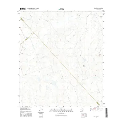
2016 Map of Bald Mound
USGS Topo · Published 2016About this map
The rolling ranchlands where Wilson, Karnes, and Gonzales counties meet are defined by a complex network of seasonal drainages and isolated high points. Bald Mound and Rocky Mound serve as the primary topographic anchors in this landscape, overlooking a series of creek systems that include Mound Cr, Board Br, and Wickey Br. The presence of Joye Ranch Airport in the northeast corner near FM 108 S highlights the continued importance of private aviation in managing large Texas landholdings. This survey provides a clear view of the rural road network, with numbered county roads like Co RD 211 and Co RD 534 tracing the property lines and natural contours of the brush country. Water resources, such as the small Kelly Lake, are critical features in this environment, supporting local livestock operations across the intersection of these three South Texas counties.
Find a feature on this map
40 named features on this map. Tap any name to fly to it.
Don’t see what you’re looking for? This feature index may not catch every label — zoom into the map to look around manually.
Map Details
Editions of this 2016 Bald Mound Map
This is the sole edition of this map. No revisions or reprints were ever made.
Other maps of this area

1920 · Smiley
USGS Topo · 1:125,000

1942 · Dewville
USGS Topo · 1:62,500

1953 · Seguin
USGS Topo · 1:250,000

1956 · Dewville
USGS Topo · 1:62,500

1958 · Seguin
USGS Topo · 1:250,000

1961 · Sample
USGS Topo · 1:24,000

1961 · Nixon
USGS Topo · 1:24,000
1961 · Pilgrim
USGS Topo · 1:24,000

1961 · New Davy
USGS Topo · 1:24,000

1961 · Gillett
USGS Topo · 1:24,000