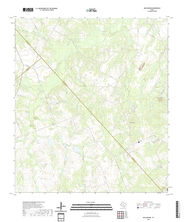
2022 Map of Bald Mound
USGS Topo · Published 2022About this map
A tri-county boundary corner defines the southern portion of this landscape, where Gonzales, Wilson, and Karnes counties meet. The terrain is characterized by a series of branching waterways, most notably the winding course of Mound Cr, which is fed by tributaries like Board Br and Rusten Br. Notable high points include Bald Mound and Rocky Mound, which stand as prominent landmarks in an area otherwise dominated by the subtle drainage basins of Elm Cr and Brushy Cr. For those researching local family history, the presence of the Griffin Cem near the central-eastern boundary provides a specific point of interest. The area's rural character is maintained through a network of county roads, such as Co RD 277 and Co RD 534, connecting various creek-side land tracts.
Find a feature on this map
40 named features on this map. Tap any name to fly to it.
Don’t see what you’re looking for? This feature index may not catch every label — zoom into the map to look around manually.
Map Details
Editions of this 2022 Bald Mound Map
This is the sole edition of this map. No revisions or reprints were ever made.
Other maps of this area

1920 · Smiley
USGS Topo · 1:125,000

1942 · Dewville
USGS Topo · 1:62,500

1953 · Seguin
USGS Topo · 1:250,000

1956 · Dewville
USGS Topo · 1:62,500

1958 · Seguin
USGS Topo · 1:250,000

1961 · Sample
USGS Topo · 1:24,000

1961 · Nixon
USGS Topo · 1:24,000
1961 · Pilgrim
USGS Topo · 1:24,000

1961 · New Davy
USGS Topo · 1:24,000

1961 · Gillett
USGS Topo · 1:24,000