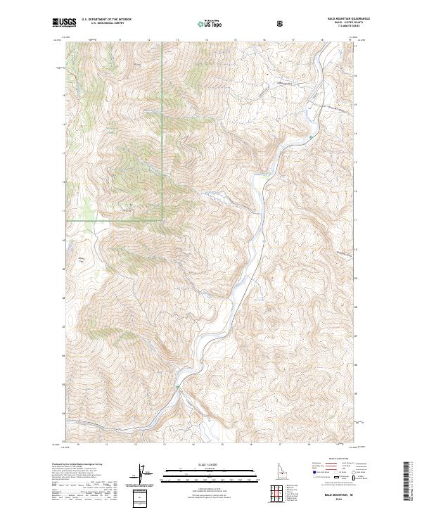
2024 Map of Bald Mountain
USGS Topo · Published 2024About this map
The Challis National Forest dominates the western portion of this Custer County landscape, where the terrain descends sharply toward the central valley of the Salmon River. This waterway serves as the primary corridor through the region, flanked by the distinct level topography of Centennial Flat and Povert Flat. The map reveals a network of high-elevation drainages such as Juliette Creek and Lyon Creek that feed into the main river system from the west, while landmarks like Malm Gulch and Bradshaw Gulch define the eastern rises.
Find a feature on this map
23 named features on this map. Tap any name to fly to it.
Don’t see what you’re looking for? This feature index may not catch every label — zoom into the map to look around manually.
Map Details
Editions of this 2024 Bald Mountain Map
This is the sole edition of this map. No revisions or reprints were ever made.
Other maps of this area

1929 · Bayhorse
USGS Topo · 1:125,000

1957 · Challis
USGS Topo · 1:250,000

1960 · Challis
USGS Topo · 1:250,000

1963 · Challis
USGS Topo · 1:250,000

1963 · Bald Mountain
USGS Topo · 1:24,000

1963 · Bayhorse Lake
USGS Topo · 1:24,000

1963 · Bayhorse
USGS Topo · 1:24,000

1963 · Clayton
USGS Topo · 1:24,000
1963 · Ziegler Basin
USGS Topo · 1:24,000
1963 · Potaman Peak
USGS Topo · 1:24,000