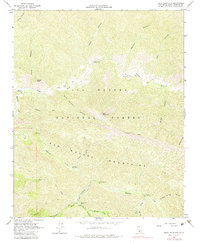
1964 Map of Bald Mountain
USGS Topo · Published 1983About this map
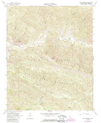
San Rafael Mountains terrain dominates this portion of the Los Padres National Forest, where the deep drainage of the Sisquoc River separates Wheat Peak from the high ridges of the Hurricane Deck Trail. The landscape is defined by its complex network of seasonal watercourses, including Manzana Creek and Bald Mountain Canyon. Human presence is marked by isolated backcountry infrastructure, such as the Wellman Grave and several scattered Ruins that suggest earlier activity along the riverbanks. The mapping of a single Mine and various recreational sites like the Nira Campground and Coldwater Campground illustrates the forest's dual history of resource extraction and mid-century wilderness access. Travel through this area during the 1960s was limited to a few primitive routes, including the Jeep Trail and the Sisquoc River Trail.
Find a feature on this map
38 named features on this map. Tap any name to fly to it.
Don’t see what you’re looking for? This feature index may not catch every label — zoom into the map to look around manually.
Map Details
Editions of this 1964 Bald Mountain Map
5 editions found
Other maps of this area

1902 · Santa Ynez
USGS Topo · 1:125,000

1905 · Santa Ynez
USGS Topo · 1:125,000

1905 · Lompoc
USGS Topo · 1:125,000

1941 · San Rafael Mtn.
USGS Topo · 1:62,500

1941 · McPherson Peak
USGS Topo · 1:62,500

1942 · Lompoc
USGS Topo · 1:125,000

1942 · San Rafael Mtn.
USGS Topo · 1:62,500

1942 · Tepusquet Peak
USGS Topo · 1:62,500

1942 · Los Olivos
USGS Topo · 1:62,500

1943 · San Rafael Mtn.
USGS Topo · 1:62,500