
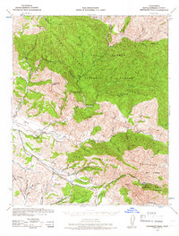
1942 Map of Tepusquet Peak
USGS Topo · Published 1957About this map
The San Rafael Mountains define this landscape within the Los Padres National Forest, where a network of ranching outposts and canyons reveals the mid-century character of northern Santa Barbara County. Extensive cattle operations are evident through family-named landmarks like Sisquoc Ranch, Adams Ranch, and Diamond-T Ranch, clustered primarily along the drainage of the Sisquoc River and Foxen Canyon.
Find a feature on this map
46 named features on this map. Tap any name to fly to it.
Don’t see what you’re looking for? This feature index may not catch every label — zoom into the map to look around manually.
Map Details
Editions of this 1942 Tepusquet Peak Map
2 editions found
Other maps of this area

1902 · Santa Ynez
USGS Topo · 1:125,000

1905 · Santa Ynez
USGS Topo · 1:125,000

1905 · Lompoc
USGS Topo · 1:125,000

1912 · McKittrick
USGS Topo · 1:125,000

1922 · Nipomo
USGS Topo · 1:62,500

1937 · Branch Mtn
USGS Topo · 1:48,000

1941 · San Rafael Mtn.
USGS Topo · 1:62,500

1941 · Caliente Mountain
USGS Topo · 1:62,500

1941 · McPherson Peak
USGS Topo · 1:62,500

1942 · Lompoc
USGS Topo · 1:125,000