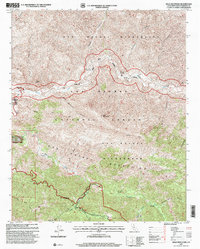
1995 Map of Bald Mountain
USGS Topo · Published 2000About this map
The high backcountry of the San Rafael Wilderness and Los Padres National Forest is charted here, centered on the dramatic intersection of river drainages and ridgeline trails. The northern half of the map is dominated by the winding course of the Sisquoc River, which flows past historical points of interest such as the Manzana Schoolhouse Campsite and several established backcountry camps including Mormon Campsite and Miller Campsite.
Find a feature on this map
38 named features on this map. Tap any name to fly to it.
Don’t see what you’re looking for? This feature index may not catch every label — zoom into the map to look around manually.
Map Details
Editions of this 1995 Bald Mountain Map
This is the sole edition of this map. No revisions or reprints were ever made.
Other maps of this area

1902 · Santa Ynez
USGS Topo · 1:125,000

1905 · Santa Ynez
USGS Topo · 1:125,000

1905 · Lompoc
USGS Topo · 1:125,000

1941 · San Rafael Mtn.
USGS Topo · 1:62,500

1941 · McPherson Peak
USGS Topo · 1:62,500

1942 · Lompoc
USGS Topo · 1:125,000

1942 · San Rafael Mtn.
USGS Topo · 1:62,500

1942 · Tepusquet Peak
USGS Topo · 1:62,500

1942 · Los Olivos
USGS Topo · 1:62,500

1943 · San Rafael Mtn.
USGS Topo · 1:62,500