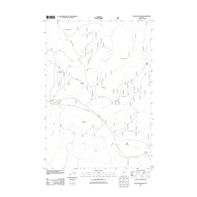
2012 Map of Bald Mountain
USGS Topo · Published 2012About this map
Bald Mountain City and the high ridges of the Bighorn Mountains define this landscape in the early 21st century. The map illustrates a high-altitude wilderness shaped by recreation and historical routes, where the Little Bighorn River begins its descent through steep drainage systems like Half Ounce Cr and Gold Cr. High peaks including Bald Mountain, Duncum Mountain, and Little Bald Mountain dominate the topography, providing a look at the mountain passes and gulches that have long served as transit corridors.
Find a feature on this map
32 named features on this map. Tap any name to fly to it.
Don’t see what you’re looking for? This feature index may not catch every label — zoom into the map to look around manually.
Map Details
Editions of this 2012 Bald Mountain Map
This is the sole edition of this map. No revisions or reprints were ever made.
Other maps of this area

1898 · Bald Mountain
USGS Topo · 1:125,000

1901 · Bald Mountain
USGS Topo · 1:125,000

1955 · Sheridan
USGS Topo · 1:250,000

1958 · Sheridan
USGS Topo · 1:250,000

1960 · Medicine Wheel
USGS Topo · 1:24,000

1960 · Boyd Ridge
USGS Topo · 1:24,000

1960 · Mexican Hill
USGS Topo · 1:24,000

1960 · Hidden Tepee Creek
USGS Topo · 1:24,000

1960 · Bear Creek Ranch
USGS Topo · 1:24,000
1960 · Bald Mountain
USGS Topo · 1:24,000