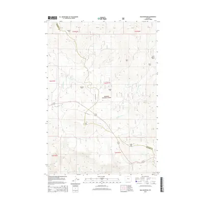
2015 Map of Bald Mountain
USGS Topo · Published 2015About this map
The high-elevation terrain of Bighorn National Forest dominates this study of the Sheridan and Big Horn county line. Centered on the massif of Bald Mtn and Little Bald Mtn, the landscape is defined by deep drainages and ridges, most notably the Little Bighorn Valley to the northeast. Historical access through this mountain pass is traced by Old US Hwy 14A, which winds across the plateau near Wyoming Gulch and Rooster Hill.
Find a feature on this map
28 named features on this map. Tap any name to fly to it.
Don’t see what you’re looking for? This feature index may not catch every label — zoom into the map to look around manually.
Map Details
Editions of this 2015 Bald Mountain Map
This is the sole edition of this map. No revisions or reprints were ever made.
Other maps of this area

1898 · Bald Mountain
USGS Topo · 1:125,000

1901 · Bald Mountain
USGS Topo · 1:125,000

1955 · Sheridan
USGS Topo · 1:250,000

1958 · Sheridan
USGS Topo · 1:250,000

1960 · Medicine Wheel
USGS Topo · 1:24,000

1960 · Boyd Ridge
USGS Topo · 1:24,000

1960 · Mexican Hill
USGS Topo · 1:24,000

1960 · Hidden Tepee Creek
USGS Topo · 1:24,000

1960 · Bear Creek Ranch
USGS Topo · 1:24,000
1960 · Bald Mountain
USGS Topo · 1:24,000