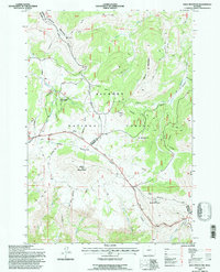
1993 Map of Bald Mountain
USGS Topo · Published 1997About this map
The ancient Medicine Wheel and the high-elevation slopes of the Bighorn National Forest define this terrain during the early 1990s. The map captures the divide between Big Horn and Sheridan Counties, an area where high peaks like Bald Mountain and Duncum Mountain rise above the drainage of the Little Bighorn River. Of particular interest to local historians is the Bald Mountain City (Site), a vestige of former settlement in the high country, along with utilitarian locations such as Cow Camp and Sheep Camp. The landscape is a network of ridges and watercourses, including Devil's Canyon and Porcupine Creek. Transportation through these heights is centered on the Medicine Wheel Passage Scenic Byway, which provides access to the Medicine Wheel Ranger Station and various points of interest near the summit. The presence of several Gravel Pits and various pipelines indicates the continued intersection of industrial needs with this protected forest land.
Find a feature on this map
33 named features on this map. Tap any name to fly to it.
Don’t see what you’re looking for? This feature index may not catch every label — zoom into the map to look around manually.
Map Details
Editions of this 1993 Bald Mountain Map
This is the sole edition of this map. No revisions or reprints were ever made.
Other maps of this area

1898 · Bald Mountain
USGS Topo · 1:125,000

1901 · Bald Mountain
USGS Topo · 1:125,000

1955 · Sheridan
USGS Topo · 1:250,000

1958 · Sheridan
USGS Topo · 1:250,000

1960 · Medicine Wheel
USGS Topo · 1:24,000

1960 · Boyd Ridge
USGS Topo · 1:24,000

1960 · Mexican Hill
USGS Topo · 1:24,000

1960 · Hidden Tepee Creek
USGS Topo · 1:24,000

1960 · Bear Creek Ranch
USGS Topo · 1:24,000
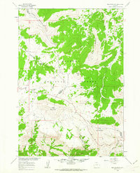
1960 · Bald Mountain
USGS Topo · 1:24,000