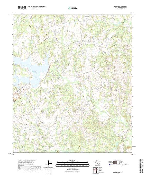
2022 Map of Bald Prairie
USGS Topo · Published 2022About this map
The community of Bald Prairie anchors this portion of Robertson County, where the central Texas landscape is defined by the extensive waters of Twin Oak Reservoir and a dense network of creek drainages. The area’s history is preserved in small rural burial grounds like Bald Prairie Cem and the Wesley Chapel Cem, which stand alongside a complex system of county roads and state farm-to-market routes.
Find a feature on this map
39 named features on this map. Tap any name to fly to it.
Don’t see what you’re looking for? This feature index may not catch every label — zoom into the map to look around manually.
Map Details
Editions of this 2022 Bald Prairie Map
This is the sole edition of this map. No revisions or reprints were ever made.
Other maps of this area

1925 · Marquez No. 1
USGS Topo · 1:48,000

1925 · Marquez No. 4
USGS Topo · 1:48,000

1927 · Marquez
USGS Topo · 1:62,500

1930 · Marquez
USGS Topo · 1:62,500

1954 · Waco
USGS Topo · 1:250,000

1955 · Waco
USGS Topo · 1:250,000

1962 · Petteway
USGS Topo · 1:24,000
1962 · Owensville
USGS Topo · 1:24,000
1965 · Marquez
USGS Topo · 1:24,000
1965 · Camp Creek Lake
USGS Topo · 1:24,000