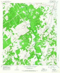
1965 Map of Marquez
USGS Topo · Published 1967About this map
The Navasota River winds through the heart of this mid-1960s landscape, defining the meandering boundary between Robertson and Leon counties. The town of Marquez sits at the northeastern corner of the sheet, serving as a hub for the Missouri Pacific railroad line which cuts diagonally across the terrain toward Ridge. This corridor reveals a cluster of rural landmarks, from family and community burial grounds like Bateman Cem and Winn Cem to the local gathering point at Watson Chapel in the community of Venetia.
Find a feature on this map
45 named features on this map. Tap any name to fly to it.
Don’t see what you’re looking for? This feature index may not catch every label — zoom into the map to look around manually.
Map Details
Editions of this 1965 Marquez Map
2 editions found
Other maps of this area

1925 · Marquez No. 1
USGS Topo · 1:48,000

1925 · Marquez No. 4
USGS Topo · 1:48,000

1927 · Marquez
USGS Topo · 1:62,500

1930 · Marquez
USGS Topo · 1:62,500

1954 · Waco
USGS Topo · 1:250,000

1955 · Waco
USGS Topo · 1:250,000

1956 · Jewett
USGS Topo · 1:62,500
1964 · Hilltop Lakes
USGS Topo · 1:24,000

1964 · Margie
USGS Topo · 1:24,000

1965 · Jewett
USGS Topo · 1:24,000