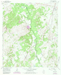
1965 Map of Marquez
USGS Topo · Published 1983About this map
The Navasota River meanders through the heart of this East Texas landscape, defining the border between Leon and Robertson counties. In the mid-1960s, this area centered on Marquez was a mosaic of riparian bottomlands and upland ridges, characterized by numerous oxbow lakes and sloughs like Bear Rough Lake and Wind Slough. The Missouri Pacific railroad serves as the primary industrial spine of the region, running north-south through the village of Marquez and near the settlement of Venetia.
Find a feature on this map
47 named features on this map. Tap any name to fly to it.
Don’t see what you’re looking for? This feature index may not catch every label — zoom into the map to look around manually.
Map Details
Editions of this 1965 Marquez Map
2 editions found
Other maps of this area

1925 · Marquez No. 1
USGS Topo · 1:48,000

1925 · Marquez No. 4
USGS Topo · 1:48,000

1927 · Marquez
USGS Topo · 1:62,500

1930 · Marquez
USGS Topo · 1:62,500

1954 · Waco
USGS Topo · 1:250,000

1955 · Waco
USGS Topo · 1:250,000

1956 · Jewett
USGS Topo · 1:62,500
1964 · Hilltop Lakes
USGS Topo · 1:24,000

1964 · Margie
USGS Topo · 1:24,000

1965 · Jewett
USGS Topo · 1:24,000