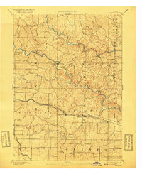
1891 Map of Baldwin
USGS Topo · Published 1917About this map
Maquoketa River and its North Fork carve through the landscape of Jackson County, anchoring a late 19th-century network of small milling and agricultural settlements. The topography is defined by the sharp descent from the uplands down to the river bottoms, where villages like Ozark, Clay Mills, and Canton are positioned along the winding watercourses. This 1889 survey captures the era when local commerce relied heavily on both these streams and the expanding rail lines that skirted the valleys.
Find a feature on this map
32 named features on this map. Tap any name to fly to it.
Don’t see what you’re looking for? This feature index may not catch every label — zoom into the map to look around manually.
Map Details
Editions of this 1891 Baldwin Map
3 editions found
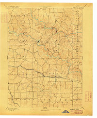
Other maps of this area

1889 · Tipton
USGS Topo · 1:62,500

1890 · Tipton
USGS Topo · 1:62,500

1891 · DeWitt
USGS Topo · 1:62,500

1891 · Monticello
USGS Topo · 1:62,500

1891 · Maquoketa
USGS Topo · 1:62,500

1891 · Baldwin
USGS Topo · 1:62,500

1892 · Wheatland
USGS Topo · 1:62,500

1894 · Wheatland
USGS Topo · 1:62,500

1900 · Anamosa
USGS Topo · 1:125,000

1901 · Peosta
USGS Topo · 1:125,000