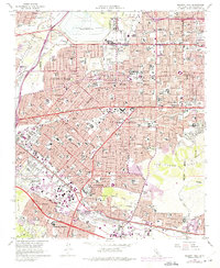
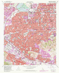
1966 Map of Baldwin Park
USGS Topo · Published 1975About this map
Baldwin Park and its surrounding San Gabriel Valley neighbors are shown during a period of intense suburban infill and industrial expansion. The northern portion of the quadrangle is dominated by the massive Santa Fe Flood Control Basin and the Santa Fe Dam, while the landscape to the west is scarred by numerous Gravel Pits and a Quarry along the San Gabriel River. This survey captures the transition from agricultural roots to a dense grid of residential streets and civic centers, including the City Hall and Post Office in La Puente. The rail-dependent industrial history of the region is evident in the multiple lines of the Southern Pacific, Pacific Electric, and Union Pacific railroads serving points like Irwindale Siding. Unique landmarks of the era, such as the Irwindale Raceway and the Oakdale (Cem) near Glendora, sit alongside the growing networks of the San Bernardino Freeway and Pomona Freeway.
Find a feature on this map
55 named features on this map. Tap any name to fly to it.
Don’t see what you’re looking for? This feature index may not catch every label — zoom into the map to look around manually.
Map Details
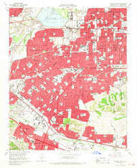
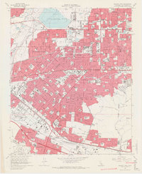
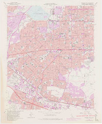
Editions of this 1966 Baldwin Park Map
5 editions found
Other maps of this area

1894 · Los Angeles
USGS Topo · 1:62,500

1894 · Pomona
USGS Topo · 1:62,500

1896 · Pasadena
USGS Topo · 1:62,500

1896 · Anaheim
USGS Topo · 1:62,500

1896 · Downey
USGS Topo · 1:62,500

1897 · Pomona
USGS Topo · 1:62,500

1898 · Pomona
USGS Topo · 1:62,500

1898 · Anaheim
USGS Topo · 1:62,500

1899 · Downey
USGS Topo · 1:62,500

1900 · Pasadena
USGS Topo · 1:62,500