
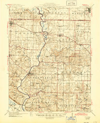
1914 Map of Baldwin
USGS Topo · Published 1914About this map
The Kaskaskia River snakes through a landscape defined by small agricultural settlements and a dense network of early 20th-century rural schools. Surveyed just before the Great War, this area of southern Illinois shows a community centered on river transport and the growing influence of the Mobile and Ohio and Illinois Southern railroads. The map reveals the intricate social fabric of the day through its named schoolhouses, such as the Charter Oak School and Jordan Grove School, which served dispersed farmsteads across townships like Baldwin and Evansville.
Find a feature on this map
68 named features on this map. Tap any name to fly to it.
Don’t see what you’re looking for? This feature index may not catch every label — zoom into the map to look around manually.
Map Details
Editions of this 1914 Baldwin Map
2 editions found
Other maps of this area

1907 · Weingarten
USGS Topo · 1:62,500

1909 · Weingarten
USGS Topo · 1:62,500

1910 · Okawville
USGS Topo · 1:62,500

1910 · Waterloo
USGS Topo · 1:62,500

1912 · New Athens
USGS Topo · 1:62,500

1912 · Baldwin
USGS Topo · 1:62,500

1913 · Waterloo
USGS Topo · 1:62,500

1914 · Coulterville
USGS Topo · 1:62,500

1915 · Renault
USGS Topo · 1:62,500

1915 · Chester
USGS Topo · 1:62,500