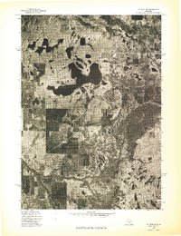
1976 Map of Baldwin SW
USGS Topo · Published 1976About this map
Big Star Lake dominates the central landscape of this 1976 orthophoto, its irregular, multi-lobed shoreline providing a stark contrast to the surrounding patchwork of northern Michigan woodlands and clearings. This aerial perspective, captured by the U.S. Geological Survey in mid-May, reveals the intricate drainage patterns and vegetation density of Lake County. Along the northern edge of the sheet, the Pere Marquette River winds through a heavily forested corridor, illustrating the natural hydrological connection between the region's inland waters and the greater basin. The map serves as a primary record of land use during the mid-seventies, showing the density of shoreline development and the geometric lines of rural property divisions and forest management roads that define this portion of the Baldwin SW quadrangle.
Find a feature on this map
2 named features on this map. Tap any name to fly to it.
Don’t see what you’re looking for? This feature index may not catch every label — zoom into the map to look around manually.
Map Details
Editions of this 1976 Baldwin SW Map
This is the sole edition of this map. No revisions or reprints were ever made.
Other maps of this area

1931 · Baldwin NW
USGS Topo · 1:31,680

1931 · Custer NE
USGS Topo · 1:31,680

1931 · Walkerville NE
USGS Topo · 1:31,680

1931 · Baldwin NE
USGS Topo · 1:31,680

1931 · Custer SE
USGS Topo · 1:31,680

1954 · Milwaukee
USGS Topo · 1:250,000

1954 · Midland
USGS Topo · 1:250,000

1958 · Midland
USGS Topo · 1:250,000

1958 · Milwaukee
USGS Topo · 1:250,000

1958 · Hesperia
USGS Topo · 1:62,500
Featured Places
- Lake Township, MI
- Troy Township, MI
- Pine Grove Beach, MI
- Lilley Township, MI
- Pleasant Plains Township, MI