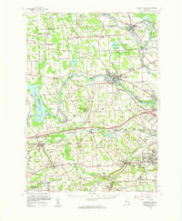
1957 Map of Baldwinsville
USGS Topo · Published 1961About this map
Baldwinsville sits at the confluence of central New York's primary waterways during the late 1950s, where the Seneca River meets the Oneida River to form the Oswego River. This network is further defined by the enduring path of the Erie Canal, which cuts through the southern reaches near Amboy and Memphis. The landscape is a mosaic of mid-century agricultural land and growing suburban corridors, most notably seen in the developments of Fairmount West and Lindbergh Lawns.
Find a feature on this map
186 named features on this map. Tap any name to fly to it.
Don’t see what you’re looking for? This feature index may not catch every label — zoom into the map to look around manually.
Map Details
Editions of this 1957 Baldwinsville Map
This is the sole edition of this map. No revisions or reprints were ever made.
Other maps of this area

1895 · Syracuse
USGS Topo · 1:62,500

1898 · Syracuse
USGS Topo · 1:62,500

1899 · Auburn
USGS Topo · 1:62,500

1899 · Skaneateles
USGS Topo · 1:62,500

1900 · Baldwinsville
USGS Topo · 1:62,500

1900 · Tully
USGS Topo · 1:62,500

1900 · Oswego
USGS Topo · 1:62,500

1900 · Fulton
USGS Topo · 1:62,500

1902 · Skaneateles
USGS Topo · 1:62,500

1902 · Weedsport
USGS Topo · 1:62,500