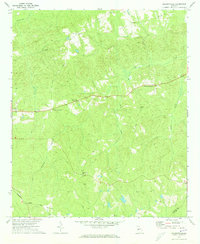
1971 Map of Baldwinville
USGS Topo · Published 1973About this map
Po Biddy Crossroads and Poplar Crossroads anchor this rural landscape in the early 1970s, where small settlements and country churches define the social geography of Talbot County. The terrain is deeply carved by the headwaters of Richland Creek and Mill Creek, creating a network of ridges and hollows that historically dictated road patterns and land use. Local landmarks like Jumpin Airfield and the Seaboard Coast Line railroad in the southwest corner indicate the area's transportation infrastructure, while a dense concentration of religious sites—including New Salem Ch, Philadelphia Ch, and Mt Zion Ch—points to the enduring importance of community congregations. Evidence of earlier rural centers can be traced through several unnamed cemeteries and small hamlets like Ypsilanti and Baldwinville, which remained largely undisturbed by major development at the time of this survey.
Find a feature on this map
26 named features on this map. Tap any name to fly to it.
Don’t see what you’re looking for? This feature index may not catch every label — zoom into the map to look around manually.
Map Details
Editions of this 1971 Baldwinville Map
2 editions found
Other maps of this area

1907 · Talbotton
USGS Topo · 1:125,000

1934 · Warm Springs
USGS Topo · 1:62,500

1935 · Thomaston
USGS Topo · 1:48,000

1936 · Warm Springs
USGS Topo · 1:62,500

1939 · Thomaston
USGS Topo · 1:62,500

1950 · Talbotton
USGS Topo · 1:24,000

1950 · Geneva
USGS Topo · 1:24,000

1950 · Talbotton
USGS Topo · 1:62,500

1955 · Talbotton
USGS Topo · 1:24,000
1955 · Geneva
USGS Topo · 1:24,000