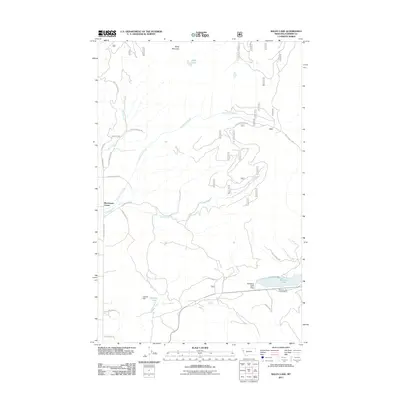
2011 Map of Baldy Lake
USGS Topo · Published 2011About this map
Blanchards Corner serves as a lone settlement reference in this high-altitude landscape of Sanders County, where drainage systems like Cedar Creek, Hinchwood Creek, and Clark Creek carve through the terrain beneath Baldy Mountain. The map reveals a complex network of forest access and mountain roads, including the descriptive Lone Man Divide Rd and Champion Land Rd, which navigate the steep topography of the Cabinet Mountains.
Find a feature on this map
26 named features on this map. Tap any name to fly to it.
Don’t see what you’re looking for? This feature index may not catch every label — zoom into the map to look around manually.
Map Details
Editions of this 2011 Baldy Lake Map
This is the sole edition of this map. No revisions or reprints were ever made.
Other maps of this area

1956 · Wallace
USGS Topo · 1:250,000

1959 · Perma
USGS Topo · 1:62,500

1959 · Plains
USGS Topo · 1:62,500

1960 · Wallace
USGS Topo · 1:250,000

1964 · Coney Peak
USGS Topo · 1:24,000

1964 · Baldy Lake
USGS Topo · 1:24,000

1964 · Weeksville
USGS Topo · 1:24,000

1964 · Lonepine
USGS Topo · 1:24,000

1964 · Hot Springs
USGS Topo · 1:24,000
1964 · Loneman Creek
USGS Topo · 1:24,000