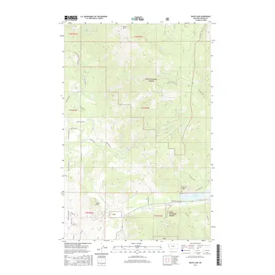
2017 Map of Baldy Lake
USGS Topo · Published 2017About this map
Baldy Mtn and the high basins of the Lolo National Forest dominate this terrain in western Montana. The landscape is defined by its dramatic elevation changes, moving from the summit of Baldy Mtn down to the shores of Baldy Lake and the significant drainage of Hinchwood Cr. In the southern portion of the quadrangle, the topography softens near Rainbow Lake and Rainbow Lake Pass, where a network of mountain roads like Dupuis Mill Rd indicates the intersection of forestry and local transit.
Find a feature on this map
45 named features on this map. Tap any name to fly to it.
Don’t see what you’re looking for? This feature index may not catch every label — zoom into the map to look around manually.
Map Details
Editions of this 2017 Baldy Lake Map
This is the sole edition of this map. No revisions or reprints were ever made.
Other maps of this area

1956 · Wallace
USGS Topo · 1:250,000

1959 · Perma
USGS Topo · 1:62,500

1959 · Plains
USGS Topo · 1:62,500

1960 · Wallace
USGS Topo · 1:250,000

1964 · Coney Peak
USGS Topo · 1:24,000

1964 · Baldy Lake
USGS Topo · 1:24,000

1964 · Weeksville
USGS Topo · 1:24,000

1964 · Lonepine
USGS Topo · 1:24,000

1964 · Hot Springs
USGS Topo · 1:24,000
1964 · Loneman Creek
USGS Topo · 1:24,000