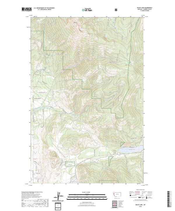
2024 Map of Baldy Lake
USGS Topo · Published 2024About this map
The Cabinet Mountains define the northwestern corner of this territory, where the Baldy Mountain Trl leads toward the summit of Baldy Mtn. High-elevation water bodies like Baldy Lake and the smaller Banana Lake are set against the steep drainages of the Lolo National Forest. The landscape is carved by numerous watercourses, including Hinchwood Creek and the long course of Clark Creek, which flow through deep valleys before reaching the flatter terrain near Rainbow Lake.
Find a feature on this map
44 named features on this map. Tap any name to fly to it.
Don’t see what you’re looking for? This feature index may not catch every label — zoom into the map to look around manually.
Map Details
Editions of this 2024 Baldy Lake Map
This is the sole edition of this map. No revisions or reprints were ever made.
Other maps of this area

1956 · Wallace
USGS Topo · 1:250,000

1959 · Perma
USGS Topo · 1:62,500

1959 · Plains
USGS Topo · 1:62,500

1960 · Wallace
USGS Topo · 1:250,000

1964 · Coney Peak
USGS Topo · 1:24,000

1964 · Baldy Lake
USGS Topo · 1:24,000

1964 · Weeksville
USGS Topo · 1:24,000

1964 · Lonepine
USGS Topo · 1:24,000

1964 · Hot Springs
USGS Topo · 1:24,000
1964 · Loneman Creek
USGS Topo · 1:24,000