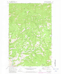
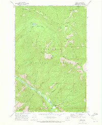
1968 Map of Baldy Mtn
USGS Topo · Published 1981About this map
Ardenvoir sits at the southern edge of this 1968 landscape, marking the primary point of settlement along the winding Entiat River. This survey captures a rugged portion of the Wenatchee National Forest where the terrain is defined by the high peaks of the Chelan Mountains, including Baldy Mtn and Forest Mtn. The map reveals a complex network of drainage systems such as Stormy Creek, Potato Creek, and Mud Creek that carve deep canyons into the topography, including McKenzie Canyon and Byers Canyon.
Find a feature on this map
50 named features on this map. Tap any name to fly to it.
Don’t see what you’re looking for? This feature index may not catch every label — zoom into the map to look around manually.
Map Details
Editions of this 1968 Baldy Mtn Map
3 editions found
Other maps of this area

1901 · Chelan
USGS Topo · 1:125,000

1957 · Wenatchee
USGS Topo · 1:250,000

1968 · Entiat
USGS Topo · 1:24,000

1968 · Tyee Mtn.
USGS Topo · 1:24,000
1968 · Stormy Mtn.
USGS Topo · 1:24,000

1968 · Ardenvoir
USGS Topo · 1:24,000

1968 · Baldy Mtn
USGS Topo · 1:24,000
1968 · Chumstick Mtn
USGS Topo · 1:24,000
1968 · Brief
USGS Topo · 1:24,000

1968 · Winesap
USGS Topo · 1:24,000