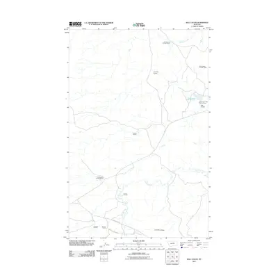
2011 Map of Ball Coulee
USGS Topo · Published 2011About this map
The Judith River Ridge anchors the southern landscape of this 2011 survey, a region defined by complex water management and rural Montana life. Local heritage is deeply rooted in the land, as evidenced by several family or community burial grounds including Messerly Cemetery, Kirkaldie Cemetery, and Chopwood Cemetery. The hydrology of the area is heavily modified for ranching or conservation, featuring the Government Field Reservoir and a series of numbered structures such as Fort Belknap Number 6 Dam and Fort Belknap Number 8 Dam. These dams control the flow of Wild Horse Creek and Big Warm Creek as they wind through the high plains. Roads like the Beaver Creek Hwy and Brookside Zortman Rd provide the primary arteries through this terrain, connecting the isolated drainages of Ball Coulee and Lone Tree Coulee to the broader Lodge Pole district.
Find a feature on this map
17 named features on this map. Tap any name to fly to it.
Don’t see what you’re looking for? This feature index may not catch every label — zoom into the map to look around manually.
Map Details
Editions of this 2011 Ball Coulee Map
This is the sole edition of this map. No revisions or reprints were ever made.
Other maps of this area

1943 · Landusky
USGS Topo · 1:125,000

1953 · Havre
USGS Topo · 1:250,000

1954 · Lewistown
USGS Topo · 1:250,000

1957 · Havre
USGS Topo · 1:250,000

1958 · Havre
USGS Topo · 1:250,000

1959 · Lewistown
USGS Topo · 1:250,000

1971 · Big Flat East
USGS Topo · 1:24,000

1971 · Bear Mountain
USGS Topo · 1:24,000

1971 · Lodge Pole NE
USGS Topo · 1:24,000
1971 · Lodge Pole
USGS Topo · 1:24,000