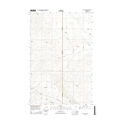
2014 Map of Ball Coulee
USGS Topo · Published 2014About this map
The Blaine and Phillips County line bisects this high-plains landscape, where the geography is defined by deep drainage systems and family legacies. Settlement patterns are evidenced by several rural burial sites, including the Messerly Cem, Kirkaldie Cem, Chopwood Cem, and Big Warm Cem, all situated near the network of roads that navigate the coulees. To the south, the Judith River Ridge rises above the basin of Big Warm Cr, while the northern reaches are marked by the winding paths of Wild Horse Cr and Lone Tree Coulee. This 2014 survey shows a region of managed water resources like the Government Field Reservoir and a transportation network anchored by the Lodge Pole Rd, reflecting the ranching and tribal lands of north-central Montana.
Find a feature on this map
24 named features on this map. Tap any name to fly to it.
Don’t see what you’re looking for? This feature index may not catch every label — zoom into the map to look around manually.
Map Details
Editions of this 2014 Ball Coulee Map
This is the sole edition of this map. No revisions or reprints were ever made.
Other maps of this area

1943 · Landusky
USGS Topo · 1:125,000

1953 · Havre
USGS Topo · 1:250,000

1954 · Lewistown
USGS Topo · 1:250,000

1957 · Havre
USGS Topo · 1:250,000

1958 · Havre
USGS Topo · 1:250,000

1959 · Lewistown
USGS Topo · 1:250,000

1971 · Big Flat East
USGS Topo · 1:24,000

1971 · Bear Mountain
USGS Topo · 1:24,000

1971 · Lodge Pole NE
USGS Topo · 1:24,000
1971 · Lodge Pole
USGS Topo · 1:24,000