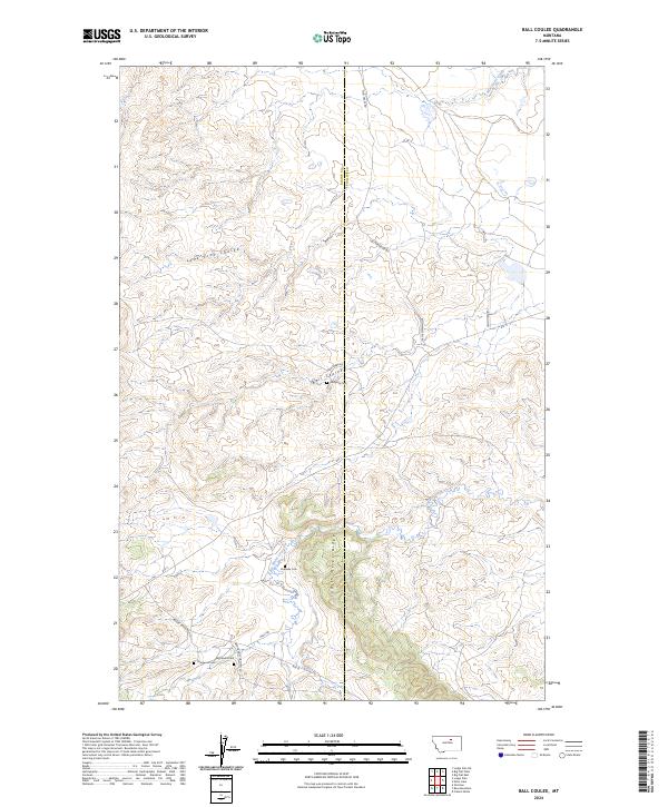
2024 Map of Ball Coulee
USGS Topo · Published 2024About this map
Judith River Ridge dominates the central topography of this Phillips County landscape, dividing the drainage patterns of several intermittent waterways. The map reveals a remote ranching and grazing environment where local life is oriented around scattered coulees and named creek beds. Small family or community burial sites, including Messerly Cem and Kirkaldie Cem, are positioned near these water sources, indicating the long-standing human presence in this part of Montana.
Find a feature on this map
25 named features on this map. Tap any name to fly to it.
Don’t see what you’re looking for? This feature index may not catch every label — zoom into the map to look around manually.
Map Details
Editions of this 2024 Ball Coulee Map
This is the sole edition of this map. No revisions or reprints were ever made.
Other maps of this area

1943 · Landusky
USGS Topo · 1:125,000

1953 · Havre
USGS Topo · 1:250,000

1954 · Lewistown
USGS Topo · 1:250,000

1957 · Havre
USGS Topo · 1:250,000

1958 · Havre
USGS Topo · 1:250,000

1959 · Lewistown
USGS Topo · 1:250,000

1971 · Big Flat East
USGS Topo · 1:24,000

1971 · Bear Mountain
USGS Topo · 1:24,000

1971 · Lodge Pole NE
USGS Topo · 1:24,000
1971 · Lodge Pole
USGS Topo · 1:24,000