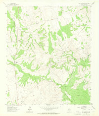
1963 Map of Ballinger Ranch
USGS Topo · Published 1964About this map
Ballinger Ranch and Shafter Ranch anchor this West Texas landscape in Glasscock County, showing the region as it was surveyed in the early 1960s. The terrain is defined by the convergence of drainage systems, including Polecat Creek and Apple Creek, along with the West Fork and Middle Fork. This period reflects an active ranching and resource extraction economy, with several Oil Wells and a Gravel Pit scattered across the quadrangle. A network of Pipelines and fence lines, indicated by fine dashed red lines, underscores the infrastructure required to manage these land interests. The map provides a look at the rural property boundaries and water sources essential to livestock operations in this arid environment before modern development and further energy expansion altered the local topography.
Find a feature on this map
10 named features on this map. Tap any name to fly to it.
Don’t see what you’re looking for? This feature index may not catch every label — zoom into the map to look around manually.
Map Details
Editions of this 1963 Ballinger Ranch Map
2 editions found
Other maps of this area

1941 · Morita
USGS Topo · 1:62,500

1941 · Big Spring South
USGS Topo · 1:62,500

1942 · Big Spring South
USGS Topo · 1:62,500

1949 · Morita
USGS Topo · 1:62,500

1954 · Big Spring
USGS Topo · 1:250,000

1954 · San Angelo
USGS Topo · 1:250,000

1958 · San Angelo
USGS Topo · 1:250,000

1958 · Big Spring
USGS Topo · 1:250,000

1963 · Ballinger Ranch
USGS Topo · 1:24,000

1963 · Currie Reservoir
USGS Topo · 1:24,000