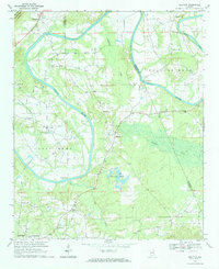
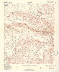
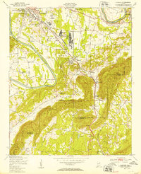
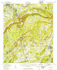
1967 Map of Ballplay
USGS Topo · Published 1984About this map
The winding Coosa River defines the landscape of this corner of Alabama, carving deep horseshoe turns at Coats Bend and Pollard Bend. In the late 1960s, the river remained a critical geographic barrier and corridor, evidenced by the numerous crossings still noted such as Croft Ferry, Adams Ferry, Wagnon Ferry, and Baskin Ferry. These ferries served rural communities and family farms established along the fertile banks and the drainage of Ballplay Creek.
Find a feature on this map
30 named features on this map. Tap any name to fly to it.
Don’t see what you’re looking for? This feature index may not catch every label — zoom into the map to look around manually.
Map Details
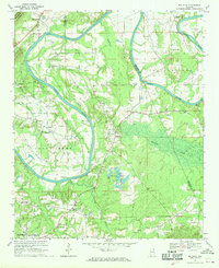
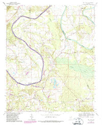
Editions of this 1967 Ballplay Map
3 editions found
Other maps of this area

1893 · Fort Payne
USGS Topo · 1:125,000

1898 · Fort Payne
USGS Topo · 1:125,000

1900 · Fort Payne
USGS Topo · 1:125,000

1900 · Anniston
USGS Topo · 1:125,000
1936 · Roden Gap
USGS Topo · 1:24,000
1947 · Colvin Gap
USGS Topo · 1:24,000
1947 · Glencoe
USGS Topo · 1:24,000
1947 · Jacksonville
USGS Topo · 1:62,500

1953 · Atlanta
USGS Topo · 1:250,000

1955 · Rome
USGS Topo · 1:250,000