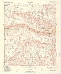
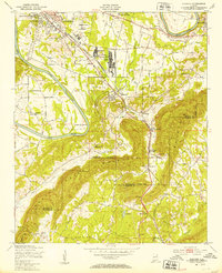
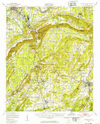
1967 Map of Ballplay
USGS Topo · Published 1987About this map
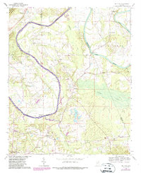
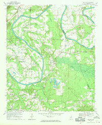
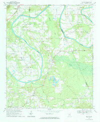
The Coosa River meanders through the heart of this landscape, defining the boundary between Etowah and Cherokee counties. By the mid-1960s, the river’s character was fundamentally altered by the creation of H Neely Henry Lake, a major reservoir project by the Alabama Power Company that submerged former riverbanks. Despite this modernization, the map preserves the locations of traditional river crossings including Croft Ferry, Adams Ferry, Wagnon Ferry, and Baskin Ferry, reflecting a reliance on water transport that predated the impoundment.
Find a feature on this map
35 named features on this map. Tap any name to fly to it.
Don’t see what you’re looking for? This feature index may not catch every label — zoom into the map to look around manually.
Map Details
Editions of this 1967 Ballplay Map
3 editions found
Other maps of this area

1893 · Fort Payne
USGS Topo · 1:125,000

1898 · Fort Payne
USGS Topo · 1:125,000

1900 · Fort Payne
USGS Topo · 1:125,000

1900 · Anniston
USGS Topo · 1:125,000
1936 · Roden Gap
USGS Topo · 1:24,000
1947 · Colvin Gap
USGS Topo · 1:24,000
1947 · Glencoe
USGS Topo · 1:24,000
1947 · Jacksonville
USGS Topo · 1:62,500

1953 · Atlanta
USGS Topo · 1:250,000

1955 · Rome
USGS Topo · 1:250,000