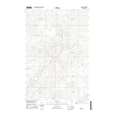
2016 Map of Balsam
USGS Topo · Published 2016About this map
Balsam and the surrounding Aitkin County wetlands define this landscape of interconnected waterways and forest roads. The area is dominated by an extensive network of lakes and rivers, most notably the northern reaches of Big Sandy Lake and the winding course of the Prairie River. These waters were historical routes for travel and timber, evidenced by the numerous smaller bodies like Savanna Lake, Wolf Lake, and Glacier Lake that dot the terrain. The presence of the W Savanna River and Tamarack River highlights the complex drainage patterns of this lake-rich region.
Find a feature on this map
42 named features on this map. Tap any name to fly to it.
Don’t see what you’re looking for? This feature index may not catch every label — zoom into the map to look around manually.
Map Details
Editions of this 2016 Balsam Map
This is the sole edition of this map. No revisions or reprints were ever made.
Other maps of this area

1953 · Duluth
USGS Topo · 1:250,000

1958 · Duluth
USGS Topo · 1:250,000

1969 · Island
USGS Topo · 1:24,000

1970 · Tamarack
USGS Topo · 1:24,000

1970 · Little Prairie Lake
USGS Topo · 1:24,000
1970 · Vanduse Lake
USGS Topo · 1:24,000

1970 · Balsam
USGS Topo · 1:24,000
1970 · Ball Bluff
USGS Topo · 1:24,000

1970 · Libby
USGS Topo · 1:24,000

1970 · Wright
USGS Topo · 1:24,000