
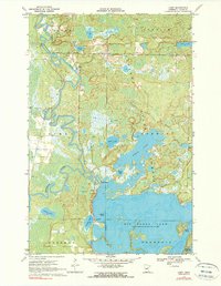
1970 Map of Libby
USGS Topo · Published 1972About this map
Mississippi River oxbows and extensive wetlands define the landscape near the small settlement of Libby, recorded here just after the 1970 field check. The area is dominated by the sprawling waters of Big Sandy Lake and Aitkin Lake, which provide a complex network of channels and islands such as Emerald Island and Battle Island. These waters reflect the region's importance as a seasonal recreation and conservation hub within the Savanna State Forest and Savanna Portage State Park.
Find a feature on this map
24 named features on this map. Tap any name to fly to it.
Don’t see what you’re looking for? This feature index may not catch every label — zoom into the map to look around manually.
Map Details
Editions of this 1970 Libby Map
2 editions found
Other maps of this area

1953 · Duluth
USGS Topo · 1:250,000

1958 · Duluth
USGS Topo · 1:250,000

1970 · Tamarack
USGS Topo · 1:24,000

1970 · Rabey
USGS Topo · 1:24,000

1970 · Palisade
USGS Topo · 1:24,000

1970 · Sanders Lake
USGS Topo · 1:24,000
1970 · Vanduse Lake
USGS Topo · 1:24,000

1970 · Balsam
USGS Topo · 1:24,000
1970 · Ball Bluff
USGS Topo · 1:24,000
1970 · Minnewawa
USGS Topo · 1:24,000