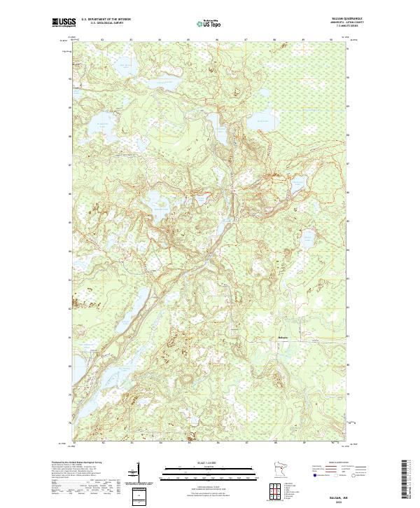
2022 Map of Balsam
USGS Topo · Published 2022About this map
Balsam and the surrounding Aitkin County wetlands are defined by an intricate network of glacial lakes and river systems that historically supported vital travel routes through Northern Minnesota. The landscape is dominated by the W Savanna River and E Savanna River, connected by the historic Savanna Portage Trl. This area serves as a significant drainage divide, where waters flow toward both the Mississippi River and Lake Superior basins. A dense web of modern forest roads and recreational paths, such as the Black Spruce Trl and Esker Trl, now navigate the complex terrain of bogs and ridges. Notable water bodies including Big Sandy Lake, Wolf Lake, and Remote Lake anchor the region, while the Prairie River and Tamarack River meander through the southern reaches of the quadrangle near the settlement of Balsam.
Find a feature on this map
52 named features on this map. Tap any name to fly to it.
Don’t see what you’re looking for? This feature index may not catch every label — zoom into the map to look around manually.
Map Details
Editions of this 2022 Balsam Map
This is the sole edition of this map. No revisions or reprints were ever made.
Other maps of this area

1953 · Duluth
USGS Topo · 1:250,000

1958 · Duluth
USGS Topo · 1:250,000

1969 · Island
USGS Topo · 1:24,000

1970 · Tamarack
USGS Topo · 1:24,000

1970 · Little Prairie Lake
USGS Topo · 1:24,000
1970 · Vanduse Lake
USGS Topo · 1:24,000

1970 · Balsam
USGS Topo · 1:24,000
1970 · Ball Bluff
USGS Topo · 1:24,000

1970 · Libby
USGS Topo · 1:24,000

1970 · Wright
USGS Topo · 1:24,000