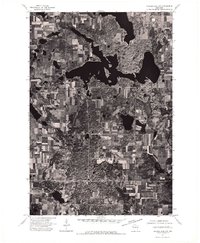
1974 Map of Balsam Lake NW
USGS Topo · Published 1976About this map
Balsam Lake serves as the central focal point of this 1974 orthophotoquad, which uses aerial imagery to document the intricate landscape of northwestern Wisconsin. The map captures the transition between the agricultural checkerboard of the surrounding countryside and the jagged, irregular shoreline of the lake itself. The small settlement of Balsam Lake is visible on the western shore, where local roads converge to serve the community. This specific aerial survey provides an unfiltered look at land use patterns during the mid-1970s, showing the precise density of forest cover and the exact boundaries of cultivated fields before later development altered the rural character of Polk County.
Find a feature on this map
2 named features on this map. Tap any name to fly to it.
Don’t see what you’re looking for? This feature index may not catch every label — zoom into the map to look around manually.
Map Details
Editions of this 1974 Balsam Lake NW Map
This is the sole edition of this map. No revisions or reprints were ever made.
Other maps of this area

1900 · St Croix Dalles
USGS Topo · 1:62,500

1901 · St Croix Dalles
USGS Topo · 1:62,500

1950 · Balsam Lake
USGS Topo · 1:62,500

1951 · Milltown
USGS Topo · 1:48,000

1951 · Frederic
USGS Topo · 1:48,000

1953 · Stillwater
USGS Topo · 1:250,000

1955 · St. Croix Dalles
USGS Topo · 1:62,500

1955 · Frederic
USGS Topo · 1:62,500

1955 · Milltown
USGS Topo · 1:62,500

1955 · Stillwater
USGS Topo · 1:250,000