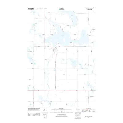
2013 Map of Balsam Lake
USGS Topo · Published 2013About this map
Balsam Lake serves as the central focal point of this 2013 survey of Polk County, where the irregular shoreline is defined by numerous residential and recreation-related access points including Breezy Bay Rd and Indianhead Shore Dr. The village core is situated around the Mill Pond, where local geography is shaped by the outflow into the Balsam Branch. This landscape is remarkably water-dense, featuring an array of kettle lakes and smaller water bodies like Lykens Lake and Wild Goose Lake that dictate the rural road grid.
Find a feature on this map
83 named features on this map. Tap any name to fly to it.
Don’t see what you’re looking for? This feature index may not catch every label — zoom into the map to look around manually.
Map Details
Editions of this 2013 Balsam Lake Map
This is the sole edition of this map. No revisions or reprints were ever made.
Other maps of this area

1900 · St Croix Dalles
USGS Topo · 1:62,500

1901 · St Croix Dalles
USGS Topo · 1:62,500

1950 · Balsam Lake
USGS Topo · 1:62,500

1951 · Milltown
USGS Topo · 1:48,000

1951 · Frederic
USGS Topo · 1:48,000

1953 · Stillwater
USGS Topo · 1:250,000

1955 · St. Croix Dalles
USGS Topo · 1:62,500

1955 · Frederic
USGS Topo · 1:62,500

1955 · Milltown
USGS Topo · 1:62,500

1955 · Stillwater
USGS Topo · 1:250,000