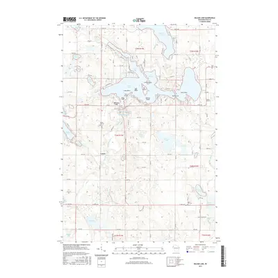
2015 Map of Balsam Lake
USGS Topo · Published 2015About this map
Balsam Lake serves as the central focal point of this Polk County landscape, defined by a complex shoreline of bays and islands including Carlson Island, Big Island, and Paradise Island. The village of Balsam Lake sits at the southern edge of the water, where the Mill Pond and Balsam Branch waterway begin their course south. To the north, the lake narrows into specialized areas like The Stumps and Boston Bay, reflecting a glacial topography that creates a dense network of smaller basins such as Rice Lake, Half Moon Lake, and Wild Goose Lake.
Find a feature on this map
114 named features on this map. Tap any name to fly to it.
Don’t see what you’re looking for? This feature index may not catch every label — zoom into the map to look around manually.
Map Details
Editions of this 2015 Balsam Lake Map
This is the sole edition of this map. No revisions or reprints were ever made.
Other maps of this area

1900 · St Croix Dalles
USGS Topo · 1:62,500

1901 · St Croix Dalles
USGS Topo · 1:62,500

1950 · Balsam Lake
USGS Topo · 1:62,500

1951 · Milltown
USGS Topo · 1:48,000

1951 · Frederic
USGS Topo · 1:48,000

1953 · Stillwater
USGS Topo · 1:250,000

1955 · St. Croix Dalles
USGS Topo · 1:62,500

1955 · Frederic
USGS Topo · 1:62,500

1955 · Milltown
USGS Topo · 1:62,500

1955 · Stillwater
USGS Topo · 1:250,000