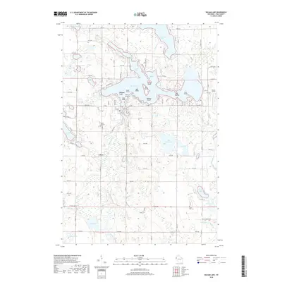
2018 Map of Balsam Lake
USGS Topo · Published 2018About this map
Balsam Lake serves as the central focal point of this Polk County landscape, defined by its intricate shoreline and numerous named landforms including Big Island, Carlson Island, and Paradise Island. The village of Balsam Lake is positioned along the western shores, where the local Mill Pond and the Balsam Lake Cem provide historical anchoring for the community. The surrounding terrain is a complex hydrologic network of smaller basins like Wild Goose Lake, Half Moon Lake, and Loveless Lake, connected by minor waterways such as Balsam Branch and Rice Cr.
Find a feature on this map
101 named features on this map. Tap any name to fly to it.
Don’t see what you’re looking for? This feature index may not catch every label — zoom into the map to look around manually.
Map Details
Editions of this 2018 Balsam Lake Map
This is the sole edition of this map. No revisions or reprints were ever made.
Other maps of this area

1900 · St Croix Dalles
USGS Topo · 1:62,500

1901 · St Croix Dalles
USGS Topo · 1:62,500

1950 · Balsam Lake
USGS Topo · 1:62,500

1951 · Milltown
USGS Topo · 1:48,000

1951 · Frederic
USGS Topo · 1:48,000

1953 · Stillwater
USGS Topo · 1:250,000

1955 · St. Croix Dalles
USGS Topo · 1:62,500

1955 · Frederic
USGS Topo · 1:62,500

1955 · Milltown
USGS Topo · 1:62,500

1955 · Stillwater
USGS Topo · 1:250,000