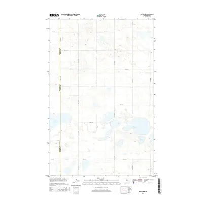
2014 Map of Balta NW
USGS Topo · Published 2014About this map
Glacial prairie potholes and scattered wetlands define this landscape along the border of McHenry Co and Pierce Co. This high-plains terrain is dominated by a series of significant water bodies, including Stony Lake, Kilgore Lake, and Smoky Lake, which serve as vital landmarks in an otherwise open agricultural expanse. The section-line road network, composed of routes like 16th Ave NE and 51st St NE, provides a rigid structure to the undulating topography typical of the North Dakota drift plain. To the northeast, the presence of Red Lake further illustrates the hydrology that has influenced land use and settlement patterns in this region. This survey captures the rural character of the area, highlighting how the natural drainage and elevation changes dictate the placement of transportation corridors across the county line.
Find a feature on this map
19 named features on this map. Tap any name to fly to it.
Don’t see what you’re looking for? This feature index may not catch every label — zoom into the map to look around manually.
Map Details
Editions of this 2014 Balta NW Map
This is the sole edition of this map. No revisions or reprints were ever made.
Other maps of this area

1954 · Tunbridge
USGS Topo · 1:24,000

1954 · Berwick
USGS Topo · 1:24,000

1954 · Towner SE
USGS Topo · 1:24,000

1954 · Minot
USGS Topo · 1:250,000

1955 · Rangeley NE
USGS Topo · 1:24,000

1957 · Rangeley SE
USGS Topo · 1:24,000

1958 · Minot
USGS Topo · 1:250,000

1958 · Balta SE
USGS Topo · 1:24,000
1958 · Balta NW
USGS Topo · 1:24,000

1958 · Balta
USGS Topo · 1:24,000