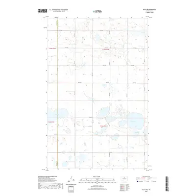
2020 Map of Balta NW
USGS Topo · Published 2020About this map
Smoky Lake and several other prominent basins characterize this corner of the North Dakota prairie, marking a landscape defined by its glacial wetlands and prairie potholes. This 2020 survey of the border between McHenry County and Pierce County reveals a highly organized section line road network, including corridors like 19th Ave NE and 52nd St NE, which slice through the township and range divisions. The distribution of water bodies such as Kilgore Lake, Stony Lake, and the smaller Red Lake suggest a terrain where agriculture must navigate around significant seasonal and permanent water. The map provides a clear look at the modern rural infrastructure of t155n r74w and surrounding townships, where the grid-like precision of the roads stands in sharp contrast to the irregular, natural shorelines of the northern plains.
Find a feature on this map
23 named features on this map. Tap any name to fly to it.
Don’t see what you’re looking for? This feature index may not catch every label — zoom into the map to look around manually.
Map Details
Editions of this 2020 Balta NW Map
This is the sole edition of this map. No revisions or reprints were ever made.
Other maps of this area

1954 · Tunbridge
USGS Topo · 1:24,000

1954 · Berwick
USGS Topo · 1:24,000

1954 · Towner SE
USGS Topo · 1:24,000

1954 · Minot
USGS Topo · 1:250,000

1955 · Rangeley NE
USGS Topo · 1:24,000

1957 · Rangeley SE
USGS Topo · 1:24,000

1958 · Minot
USGS Topo · 1:250,000

1958 · Balta SE
USGS Topo · 1:24,000
1958 · Balta NW
USGS Topo · 1:24,000

1958 · Balta
USGS Topo · 1:24,000