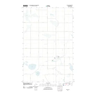
2011 Map of Balta
USGS Topo · Published 2011About this map
Balta sits at the heart of this Pierce County landscape, centered around the local water management of the Balta Dam. The surrounding terrain is defined by a series of significant prairie potholes and larger water bodies, including Red Lake in the north and the cluster of Davis Lake and Ranch Lake to the southwest. This area illustrates the classic section-line road grid characteristic of North Dakota's agricultural heartland, with numbered routes like 58th St NE and 27th Ave NE providing the primary structure for movement between farmsteads. For those looking into local history, the Mount Carmel Cemetery serves as a key landmark just west of the town center, marking a traditional site of community memory in this sparsely populated region.
Find a feature on this map
20 named features on this map. Tap any name to fly to it.
Don’t see what you’re looking for? This feature index may not catch every label — zoom into the map to look around manually.
Map Details
Editions of this 2011 Balta Map
This is the sole edition of this map. No revisions or reprints were ever made.
Other maps of this area

1953 · Devils Lake
USGS Topo · 1:250,000

1954 · Tunbridge
USGS Topo · 1:24,000

1954 · Berwick
USGS Topo · 1:24,000

1954 · Minot
USGS Topo · 1:250,000

1955 · Rugby
USGS Topo · 1:24,000

1956 · Devils Lake
USGS Topo · 1:250,000

1958 · Minot
USGS Topo · 1:250,000

1958 · Balta SE
USGS Topo · 1:24,000
1958 · Balta NW
USGS Topo · 1:24,000

1958 · Balta
USGS Topo · 1:24,000