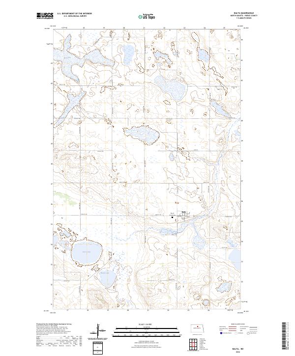
2024 Map of Balta
USGS Topo · Published 2024About this map
Balta serves as the central hub of this North Dakota landscape, a prairie community situated at the intersection of a rigid section-line road network. The town's local history is anchored by Mount Carmel Cem, which sits just to the west along 52nd St NE. The surrounding terrain is defined by the unique glaciated hydrology of the northern plains, where numerous wetlands and prairie potholes are protected within the expansive Pierce County Waterfowl Production Area. This conservation area spans several sections, preserving the habitat surrounding significant water bodies like Red Lake, Davis Lake, and Ranch Lake. The map reveals a highly structured agricultural grid, where avenues such as 24th Ave NE and 28th Ave NE provide access to the remote farmsteads and waterfowl production lands that characterize the rural economy of Pierce County.
Find a feature on this map
23 named features on this map. Tap any name to fly to it.
Don’t see what you’re looking for? This feature index may not catch every label — zoom into the map to look around manually.
Map Details
Editions of this 2024 Balta Map
This is the sole edition of this map. No revisions or reprints were ever made.
Other maps of this area

1953 · Devils Lake
USGS Topo · 1:250,000

1954 · Tunbridge
USGS Topo · 1:24,000

1954 · Berwick
USGS Topo · 1:24,000

1954 · Minot
USGS Topo · 1:250,000

1955 · Rugby
USGS Topo · 1:24,000

1956 · Devils Lake
USGS Topo · 1:250,000

1958 · Minot
USGS Topo · 1:250,000

1958 · Balta SE
USGS Topo · 1:24,000
1958 · Balta NW
USGS Topo · 1:24,000

1958 · Balta
USGS Topo · 1:24,000