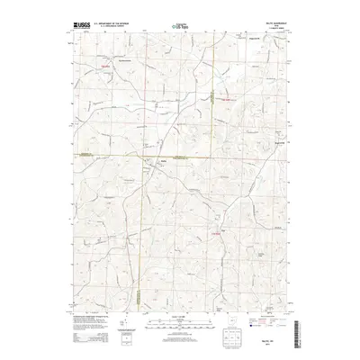
2013 Map of Baltic
USGS Topo · Published 2013About this map
Baltic serves as a central hub in this Appalachian plateau landscape, where the borders of Holmes, Coshocton, and Tuscarawas Counties meet. The terrain is defined by deeply dissected valleys and prominent landforms such as Dividing Ridge and Hothem Ridge, which separate the various tributaries of South Fork Sugar Creek and White Eyes Creek. This 2013 survey illustrates a rural region characterized by small settlements like Farmerstown and Ragersville, connected by a dense network of township roads. Numerous burial grounds, including W Lawn Cemetery and the Evans Creek Lutheran Cemetery, are scattered across the hillsides, reflecting a long-standing pattern of family and community-based land use. The water system is particularly intricate, with minor runs such as Brush Run and Cattail Creek carving through the elevation to feed the larger drainage basins that historically supported the local agricultural economy.
Find a feature on this map
130 named features on this map. Tap any name to fly to it.
Don’t see what you’re looking for? This feature index may not catch every label — zoom into the map to look around manually.
Map Details
Editions of this 2013 Baltic Map
This is the sole edition of this map. No revisions or reprints were ever made.
Other maps of this area

1911 · Newcomerstown
USGS Topo · 1:62,500

1913 · Newcomerstown
USGS Topo · 1:62,500

1913 · Coshocton
USGS Topo · 1:62,500

1914 · Navarre
USGS Topo · 1:62,500

1915 · Millersburg
USGS Topo · 1:62,500

1915 · Coshocton
USGS Topo · 1:62,500

1943 · Millersburg
USGS Topo · 1:62,500

1943 · Coshocton
USGS Topo · 1:62,500

1943 · Newcomerstown
USGS Topo · 1:62,500

1944 · Navarre
USGS Topo · 1:62,500