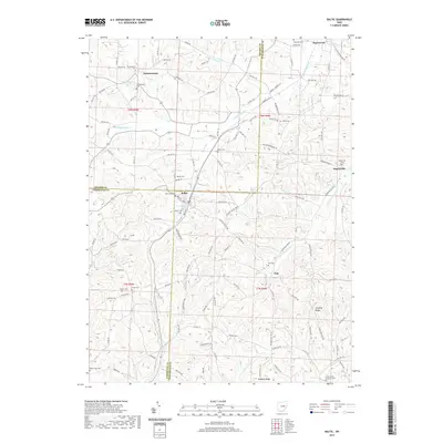
2019 Map of Baltic
USGS Topo · Published 2019About this map
Baltic serves as a central hub at the intersection of Holmes, Coshocton, and Tuscarawas counties, where the landscape is defined by the headwaters of White Eyes Cr and the E Br S Fork Sugar Cr. This 2019 survey illustrates a predominantly rural settlement pattern, where small villages like Farmerstown, Ragersville, and Fiat are connected by a dense network of township roads and county highways. The map reflects a deeply rooted community, evidenced by numerous burial grounds including the Evans Creek Lutheran Cem and Hostetler Cem. Terrain features such as Dividing Ridge and Hothern Ridge separate the various creek valleys, while Farmerstown Lake provides a notable water feature in the northwest. The presence of the Berger Cem and West Lawn Cem near the town centers highlights the area's genealogical significance.
Find a feature on this map
118 named features on this map. Tap any name to fly to it.
Don’t see what you’re looking for? This feature index may not catch every label — zoom into the map to look around manually.
Map Details
Editions of this 2019 Baltic Map
This is the sole edition of this map. No revisions or reprints were ever made.
Other maps of this area

1911 · Newcomerstown
USGS Topo · 1:62,500

1913 · Newcomerstown
USGS Topo · 1:62,500

1913 · Coshocton
USGS Topo · 1:62,500

1914 · Navarre
USGS Topo · 1:62,500

1915 · Millersburg
USGS Topo · 1:62,500

1915 · Coshocton
USGS Topo · 1:62,500

1943 · Millersburg
USGS Topo · 1:62,500

1943 · Coshocton
USGS Topo · 1:62,500

1943 · Newcomerstown
USGS Topo · 1:62,500

1944 · Navarre
USGS Topo · 1:62,500