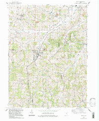
1994 Map of Baltic
USGS Topo · Published 1998About this map
Baltic sits at the intersection of Holmes, Tuscarawas, and Coshocton counties, serving as a central point for this agricultural and resource-rich landscape in the 1990s. The village is surrounded by several townships including Clark, Auburn, and Crawford, where the terrain is marked by prominent elevations like Hothem Ridge and Rock Ridge. Local industry is evidenced by the Claypit near the village and a Strip Mine to the northeast, indicating the area's continued reliance on the land's subsurface wealth.
Find a feature on this map
39 named features on this map. Tap any name to fly to it.
Don’t see what you’re looking for? This feature index may not catch every label — zoom into the map to look around manually.
Map Details
Editions of this 1994 Baltic Map
This is the sole edition of this map. No revisions or reprints were ever made.
Other maps of this area

1911 · Newcomerstown
USGS Topo · 1:62,500

1913 · Newcomerstown
USGS Topo · 1:62,500

1913 · Coshocton
USGS Topo · 1:62,500

1914 · Navarre
USGS Topo · 1:62,500

1915 · Millersburg
USGS Topo · 1:62,500

1915 · Coshocton
USGS Topo · 1:62,500

1943 · Millersburg
USGS Topo · 1:62,500

1943 · Coshocton
USGS Topo · 1:62,500

1943 · Newcomerstown
USGS Topo · 1:62,500

1944 · Navarre
USGS Topo · 1:62,500