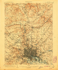
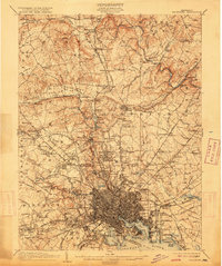
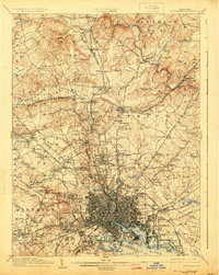
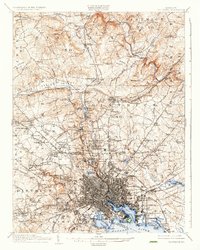
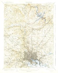
1904 Map of Baltimore
USGS Topo · Published 1907About this map
The dense urban grid of Baltimore City contrasts sharply with the surrounding rural districts in this 1902 survey of the Maryland landscape. The harbor is defined by the historic star-shaped fortifications of Fort McHenry and the industrial activity near Lazaretto Pt. To the north, the transition from city to country is marked by grand parks like Druid Hill Park and Clifton Park, while the rail corridors of the Northern Central RR and Maryland and Pennsylvania RR connect established settlements such as Cockeysville and Lutherville to the city center.
Find a feature on this map
210 named features on this map. Tap any name to fly to it.
Don’t see what you’re looking for? This feature index may not catch every label — zoom into the map to look around manually.
Map Details
Editions of this 1904 Baltimore Map
8 editions found


Other maps of this area

1892 · Laurel
USGS Topo · 1:62,500

1892 · Ellicott
USGS Topo · 1:62,500

1893 · North Point
USGS Topo · 1:62,500

1893 · Gunpowder
USGS Topo · 1:62,500

1894 · Ellicott
USGS Topo · 1:62,500

1894 · Laurel
USGS Topo · 1:62,500

1894 · Baltimore
USGS Topo · 1:62,500

1894 · Relay
USGS Topo · 1:62,500

1897 · Laurel
USGS Topo · 1:62,500

1898 · Tolchester
USGS Topo · 1:125,000