
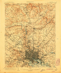
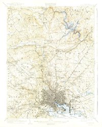
1904 Map of Baltimore
USGS Topo · Published 1911About this map
Fort McHenry stands as a sentinel over the harbor in this detailed portrait of early twentieth-century Maryland, where the urban grid of Baltimore City meets the expanding suburbs and industrial reaches of Baltimore Co.. The landscape is defined by its transit corridors, including the Northern Central RR and Maryland and Pennsylvania RR, which link the city to outlying districts such as Towson and Cockeysville. The map reveals a transition from the dense metropolitan center to the specialized sites of the surrounding countryside, from the educational grounds of Notre Dame of Maryland and St Marys Seminary to industrial landmarks like Ashland Furnace. The intricate drainage system of the Gunpowder River and the waters of Loch Raven illustrate the regional importance of these water sources as the population grew beyond the original city boundary.
Find a feature on this map
206 named features on this map. Tap any name to fly to it.
Don’t see what you’re looking for? This feature index may not catch every label — zoom into the map to look around manually.
Map Details
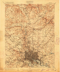
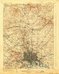
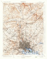
Editions of this 1904 Baltimore Map
8 editions found

Other maps of this area

1892 · Laurel
USGS Topo · 1:62,500

1892 · Ellicott
USGS Topo · 1:62,500

1893 · North Point
USGS Topo · 1:62,500

1893 · Gunpowder
USGS Topo · 1:62,500

1894 · Ellicott
USGS Topo · 1:62,500

1894 · Laurel
USGS Topo · 1:62,500

1894 · Baltimore
USGS Topo · 1:62,500

1894 · Relay
USGS Topo · 1:62,500

1897 · Laurel
USGS Topo · 1:62,500

1898 · Tolchester
USGS Topo · 1:125,000